Wildfire Risk Map San Diego: What It Means for Insurance
See how the wildfire risk map San Diego affects your home insurance, property requirements, and safety planning. Learn what steps you can take now.
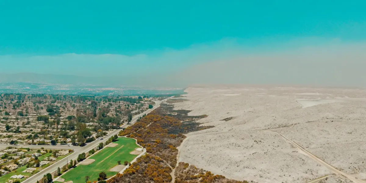
Many homeowners believe that if they don’t live next to a remote canyon, they’re safe from wildfire. The latest official maps prove that assumption is dangerously outdated. One of the most significant takeaways from the new wildfire risk map San Diego released is the expansion of "Very High" fire hazard zones into more urban and suburban neighborhoods. This is largely due to a better understanding of embers, which can travel over a mile to ignite homes far from the fire front. If you thought your property was low-risk, it’s time to look again. This article explains why the threat is growing and what it means for your community.
Pay Less for Home Insurance
and Avoid Non-Renewal?
Our partner, Five Bays Insurance Agency, offers a free policy checkup that spots hidden discounts to make sure you’re not paying more than you should.
Key Takeaways
- Know Your True Wildfire Hazard: San Diego's updated maps show that wildfire risk, driven by wind-blown embers, is expanding into more urban and suburban areas, making it essential for all homeowners to check their property's official Fire Hazard Severity Zone.
- Your Zone Impacts Your Insurance and Building Codes: Your property's designation as Moderate, High, or Very High risk isn't just a label; it directly influences your insurance premiums, eligibility for coverage, and the fire-resistant building standards you may be required to meet.
- Take Control with Actionable Steps: You can significantly lower your home's specific risk and improve its insurability by focusing on proven mitigation efforts like creating defensible space, hardening your home against embers, and having a practiced family evacuation plan.
What Does San Diego's New Wildfire Map Mean for You?
If you're a homeowner in San Diego County, you need to know about the recently updated Fire Hazard Severity Zone maps. These aren't just lines on a page; they are a critical tool that reflects the evolving reality of wildfire risk in our communities. For many residents, these new maps have reclassified their property into a higher risk zone, which has significant consequences for home insurance, building requirements, and your family's safety plan. The changes highlight a crucial fact: wildfire is no longer just a threat to remote, rural areas. The risk is expanding, and understanding where your home stands is the first step toward protecting it.
This new assessment gives you the information you need to make informed decisions and build a solid plan to keep your property and family safe. It's easy to feel overwhelmed by this news, but this information is power. Knowing your specific risk level allows you to take targeted, effective actions that can make a real difference in protecting your home and staying insurable. Insurers are using increasingly sophisticated data to assess property risk, and these official state maps are a major piece of that puzzle. By understanding what the map says about your home, you're getting ahead of the curve and positioning yourself to have productive conversations with your insurance agent about mitigation efforts that matter.
What the new map reveals about fire risk in urban areas
One of the most significant takeaways from the new maps is how they show increased fire risk in more urban and suburban neighborhoods. You might think you're safe if you don't live right next to a canyon or open space, but that's a dangerous assumption. The science behind these maps confirms that embers from a major wildfire can travel a mile or more, carried by the wind. These flying embers can ignite homes and vegetation far from the main fire front, which is why many neighborhoods previously considered lower risk are now in "very high" fire hazard zones. This expanded view of risk means that nearly everyone in the county needs to have a wildfire plan.
Key differences from the old maps
The scale of this change is substantial. According to the new assessment, the amount of land in San Diego County designated as a "very high" fire risk has grown by 26%. That's an increase from roughly 647,000 acres to over 871,000 acres. This isn't an arbitrary update. The new maps were developed using more advanced science and technology to better reflect the actual fire conditions San Diego has experienced in recent years. They incorporate better data on weather patterns, vegetation, and fire behavior, providing a more accurate and sobering picture of the current risk landscape for homeowners across the county.
Where the risk assessment data comes from
These maps are the result of a rigorous, scientific process led by CAL FIRE's Office of the State Fire Marshal. They aren't based on guesswork. To determine the Fire Hazard Severity Zones, experts analyze a combination of critical factors. This includes the area's fire history, the types of natural vegetation and how flammable they are, the shape of the land (like steep slopes where fire can travel faster), and typical fire weather patterns, such as the Santa Ana winds. By modeling how these elements interact, officials can create a detailed and reliable assessment of which areas face the greatest threat.
How Are San Diego's Fire Hazard Zones Defined?
Understanding your property's official designation is the first step toward taking control of your wildfire risk. State and local fire officials use a system called Fire Hazard Severity Zones (FHSZ) to map areas based on how likely a wildfire is to occur and how intense it could be. These aren't just abstract lines on a map; they have real-world consequences for your insurance, building codes, and safety planning. Knowing your zone helps you understand the specific threats you face and what you need to do to protect your home and family.
Explaining the Moderate, High, and Very High risk zones
California law requires CAL FIRE to map wildfire hazards across the state. These official Fire Hazard Severity Zones categorize lands based on factors like vegetation, topography, and weather patterns. Every property falls into one of three zones:
- Moderate: These areas have a lower probability of experiencing severe wildfires, though risk is never zero.
- High: These areas have an increased likelihood of wildfire, with conditions that could support significant fire growth.
- Very High: These areas face the most severe wildfire threat, with conditions that are highly conducive to fast-moving, intense fires.
These ratings help fire officials, city planners, and homeowners make informed decisions about where and how to build safely.
How your zone impacts building codes and insurance
Your property's FHSZ designation directly influences what is required of you as a homeowner. For example, new construction in a Very High Fire Hazard Severity Zone must adhere to strict fire-resistant building standards and maintain a 100-foot defensible space around the structure. Properties in High zones also have fire-resistant building requirements. Insurance companies lean heavily on these zones when assessing your property’s risk. Being in a High or Very High zone can lead to higher premiums or even a non-renewal notice if insurers feel the risk is too great without proven mitigation efforts.
Why embers are a threat, even far from the fire front
One of the biggest takeaways from recent fire maps is the growing risk in urban and suburban neighborhoods. This is largely due to embers—the small, burning pieces of debris that a wildfire can launch into the air. Wind can carry embers up to a mile ahead of the actual fire front, igniting new spot fires when they land on flammable materials like dry leaves in a gutter or a wooden deck. This is why areas that don't directly border wildlands are now being reclassified into higher-risk zones. It highlights that home hardening isn't just for rural properties; it's a critical defense for any home in a fire-prone region.
What Determines Your Property's Wildfire Risk?
When an insurer looks at your home, they aren't just looking at the building itself. They're assessing a complex puzzle of environmental and structural factors to calculate your wildfire risk score. This score is what ultimately determines your eligibility for coverage and the price of your premium. While some of these factors, like the slope of your land, are out of your control, many others are not. Understanding exactly what goes into this calculation is the first step toward taking action, reducing your risk, and making your property more insurable.
Your landscape: Vegetation, slope, and weather
The natural environment surrounding your home plays a huge role in its vulnerability. Insurers and fire officials pay close attention to the landscape, as it dictates how a wildfire might behave in your area. Key factors include the amount and type of vegetation, which acts as fuel for a fire. The terrain is also critical; because fire spreads uphill quickly, a home on a steep slope is considered higher risk. Local weather patterns, like San Diego’s notorious Santa Ana winds, create conditions where a small spark can rapidly become a major catastrophe. These elements combine to create the baseline fire hazard severity for your neighborhood.
Your location: Fire history and road access
Where your home is situated matters just as much as the landscape. Officials create Fire Hazard Severity Zone maps by analyzing data that includes past fires in the area. A location with a history of wildfires is often seen as more likely to burn again, which flags it as higher risk for insurers. Another critical factor is access. Can fire crews easily reach your home? Can you and your family evacuate safely? A property on a narrow, dead-end road with only one way out is far more dangerous—and less insurable—than a home with multiple, wide access roads.
How home protection efforts can lower your risk score
This is where you have the power to change the equation. It’s important to understand the difference between "hazard" and "risk." Hazard is the potential for wildfire in your general area based on landscape and location. Risk is the actual danger to your specific property after you’ve taken protective measures. By actively hardening your home and creating defensible space, you can significantly lower your risk score, even if you live in a high-hazard zone. Actions like clearing flammable brush, removing vulnerable trees, and upgrading to fire-resistant building materials demonstrate to insurers that you are proactively protecting your property. These mitigation efforts are your most powerful tool for staying insurable. You can start building your own mitigation strategy with a personalized Wildfire Action Plan.
How to Use San Diego's Wildfire Risk Map
Understanding your property's specific risk is the first step toward protecting it. San Diego’s official Fire Hazard Severity Zone (FHSZ) maps are the primary tool for this, used by city planners, firefighters, and insurance companies to assess wildfire danger. These maps aren't static; they are updated periodically to reflect the latest science and on-the-ground conditions. Learning to navigate and interpret these maps gives you the power to make informed decisions about home hardening, defensible space, and your family's safety. Once you know your zone, you can build a targeted Wildfire Action Plan to address your specific vulnerabilities.
Step-by-step: Find your property on the official map
Finding your home on the map is straightforward. The City of San Diego provides an official portal where you can see the most current Fire Hazard Severity Zone designations. You can view the 2025 Fire Hazard Severity Zone Map online to check if your property falls within a high-risk area. The city offers both a user-friendly interactive map and a series of detailed PDF maps broken down by neighborhood. Simply enter your address into the interactive tool to see your zone instantly. This simple search gives you a clear picture of the official risk level assigned to your property, which is the same information your insurance carrier uses.
Reading the map: Understanding zones and symbols
Once you locate your property, you’ll see it falls into a specific color-coded area. These are the Fire Hazard Severity Zones (FHSZ), which classify land based on the potential intensity of a wildfire. According to the Office of the State Fire Marshal, all land in California is grouped into one of three zones: Moderate, High, or Very High. A "Very High" designation means the area has the most severe fire hazard conditions, which can influence building codes for new construction and impact your insurance premiums and eligibility. Understanding your zone is critical for knowing what standards your property may need to meet.
When and why the fire maps are updated
These maps are updated to incorporate better science and technology, ensuring they reflect the real fire conditions San Diego faces. The latest updates show that more urban neighborhoods are now designated as "very high" fire risk zones. This isn't because the wildlands are expanding, but because we have a better understanding of how wildfires spread. Embers can travel up to a mile in the wind, igniting homes in communities that aren't directly adjacent to open space. The new maps account for this ember threat, providing a more accurate picture of the danger many homeowners face, even those in seemingly less-threatened urban areas.
Your Action Plan: What to Do Based on Your Risk Zone
Finding your home on a wildfire risk map can be unsettling, but knowledge is the first step toward control. Whether you’re in a Moderate, High, or Very High Fire Hazard Severity Zone, your next move isn’t to worry—it’s to act. Taking concrete steps to prepare your property and your family is the single most effective way to reduce your risk and demonstrate to insurers that you are a responsible homeowner. Insurers are increasingly looking for proactive mitigation efforts when making coverage decisions.
The good news is that you have significant power to change your home’s wildfire story. The work you put in now can make a critical difference if a fire approaches your neighborhood. It’s not about a single, massive project; it’s about a series of deliberate, manageable actions. Below are the four key areas where you can focus your efforts to build a more resilient home and a safer future for your family.
Create and maintain your defensible space
Think of defensible space as a buffer zone around your home. Creating this space is crucial because it slows or stops the spread of wildfire and protects your home from catching fire from direct flame contact or radiant heat. It also gives firefighters a safe area to work in. This involves clearing away dead plants, dry leaves, and other flammable materials to create a perimeter that’s harder for fire to cross. The goal is to remove the fuel that a fire needs to reach your house.
Start with the area immediately around your home—the first five feet should be completely clear of flammable materials. From there, work your way out to 100 feet (or your property line), thinning vegetation and removing dead material. You can find detailed guidelines to create defensible space that meets state and local requirements.
Harden your home against wildfire
While defensible space manages the area around your home, home hardening focuses on the structure itself. You can harden your home by using fire-resistant materials for your roof, siding, and decks. This can significantly increase your home's resilience against wildfires, especially from wind-blown embers, which can travel a mile or more ahead of a fire. Embers are the leading cause of homes igniting during a wildfire, so blocking them is critical.
Simple but effective actions include installing fine metal mesh over vents to prevent embers from entering your attic, choosing non-combustible siding, and ensuring your roof is a Class A fire-rated material. Even small fixes, like clearing debris from your gutters and sealing gaps around windows and doors, can make a huge difference in protecting your property.
Prepare your family's evacuation plan
When an evacuation order is issued, you won’t have time to figure out the details. Having a well-thought-out evacuation plan is essential for getting your family out quickly and safely. Make sure every member of your household knows the plan, including multiple escape routes from your neighborhood and a designated meeting point outside the fire area. Don’t forget to include your pets in your planning.
Your plan should also include a "Go Bag" for each person, packed with essentials like water, medications, important documents, and a change of clothes. Practice your evacuation route at different times of day so you’re familiar with the drive. A clear, practiced plan reduces panic and ensures everyone knows what to do. You can build a personalized and comprehensive Wildfire Action Plan to guide you through every step.
Sign up for local alerts and know your resources
You can’t act on information you don’t have. Staying informed is a critical part of wildfire safety, so you need to sign up for emergency alerts from your county’s office of emergency services. These systems will provide critical updates and evacuation information directly to your phone during a wildfire event. Don’t rely on a single source; have multiple ways to get information, including a battery-powered or hand-crank radio in case of power outages.
Beyond alerts, familiarize yourself with your local resources. Know the location of nearby community shelters and understand the emergency response plans for your area. Following your local fire department and emergency management office on social media can also provide real-time updates. Being connected to official information sources ensures you can make timely decisions for your family’s safety.
Related Articles
Pay Less for Home Insurance
and Avoid Non-Renewal?
Our partner, Five Bays Insurance Agency, offers a free policy checkup that spots hidden discounts to make sure you’re not paying more than you should.
Frequently Asked Questions
My home is now in a 'Very High' risk zone, but it wasn't before. Why the change? This is a common and important question. The change doesn't necessarily mean a new threat has appeared overnight. Instead, it reflects that the science used to create the maps has gotten much better. Fire officials now have a more accurate understanding of how wildfires behave, especially regarding embers. We now know that wind can carry burning embers a mile or more, which is why many suburban neighborhoods, not just those bordering canyons, have been reclassified into a higher hazard zone.
If my home is in a 'Very High' zone, will my insurance company automatically drop me? Not necessarily, but it does serve as a serious wake-up call. An official "Very High" designation is a major factor for insurers, and it signals that they will be looking at your property very closely. Think of it less as a final verdict and more as a prompt to take action. By implementing home hardening measures and creating defensible space, you can demonstrate that you are actively reducing your specific property's risk, which is exactly what insurers want to see.
What's the most important first step I can take to protect my home? It's easy to feel overwhelmed, but the most critical first step is actually quite manageable. Focus on the area immediately surrounding your home's foundation. Create a five-foot "ember-free zone" by removing all flammable materials like mulch, dead leaves, and dry plants. This simple action creates a powerful barrier that can prevent embers from igniting your house. After that, clearing your roof and gutters of debris is another high-impact, low-cost task that makes a huge difference.
The post mentions the difference between 'hazard' and 'risk.' Can you explain that again? Of course. Think of it this way: "Hazard" is the potential for wildfire in your general area based on factors you can't control, like vegetation, weather, and terrain. "Risk" is the specific danger to your actual home. While you can't change the hazard level of your neighborhood, you have a great deal of control over your home's risk. Every step you take, from clearing brush to installing vent screens, directly lowers your property's individual risk score.
How can I show my insurance agent that I've taken steps to lower my risk? Documentation is your best friend. Take clear before-and-after photos of your defensible space work. Keep receipts for any fire-resistant materials you purchase or for professional services you hire, like tree trimming. Having a formal, written summary of your efforts, such as a completed Wildfire Action Plan, provides a clear and comprehensive overview that shows your agent you are a proactive and responsible homeowner.