How to Find a Wildfire Map Near Me & Stay Safe
Get clear steps to find a wildfire map near me, understand evacuation zones, and set up alerts so you can protect your home and family during fire season.
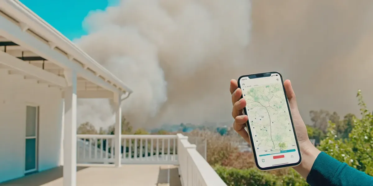
Living in California means dealing with the constant, underlying stress of wildfire season. That stress is now compounded by an insurance crisis that has left many homeowners feeling powerless, with non-renewal notices and skyrocketing premiums becoming the new normal. Taking proactive steps to protect your property is no longer just about safety; it’s about staying insurable. It starts with understanding your real-time risk. Searching for a "wildfire map near me" during an active event is crucial, but understanding your long-term risk is just as important. This article will guide you through the best tools for both, helping you stay informed, make smart decisions, and take control in a situation that feels anything but controllable.
Pay Less for Home Insurance
and Avoid Non-Renewal?
Our partner, Five Bays Insurance Agency, offers a free policy checkup that spots hidden discounts to make sure you’re not paying more than you should.
Key Takeaways
- Cross-Reference Your Maps for Accuracy: Rely on a combination of sources for the most reliable information. Use official government sites like Cal Fire for authoritative data on evacuation orders and containment, and supplement with real-time apps for the fastest alerts on new fire starts.
- Decode the Map Before an Emergency: A map is only useful if you can read it under pressure. Take time now to learn what the key symbols mean, especially fire perimeters, containment percentages, and the critical difference between an evacuation warning and an evacuation order.
- Use Maps as a Trigger for Your Plan: Information without a strategy is just noise. A wildfire map tells you when it's time to act, but your personal action plan tells you exactly what to do—what to grab, which routes to take, and how to communicate with your family.
What Is a Wildfire Map?
A wildfire map is a digital tool that shows you where fires are burning in real-time. Think of it as your go-to source for situational awareness when you see smoke on the horizon or hear reports of a nearby fire. These maps are essential for anyone living in a high-risk area because they translate complex data from satellites, ground crews, and weather stations into a visual format you can understand at a glance. They move beyond simple news reports, giving you a direct view of a fire’s location, size, and behavior.
The goal of any good wildfire map is to provide clear, timely information so you can make informed decisions about your safety, like whether to prepare for an evacuation or simply stay indoors due to poor air quality. For instance, the AirNow Fire and Smoke Map is a popular tool that displays fine particle pollution from wildfires, helping you understand air quality risks even if a fire is hundreds of miles away. Using these resources is a key step in taking control, but they are most powerful when paired with a personalized safety strategy. Having a clear Wildfire Action Plan ensures you know exactly what to do with the information you gather.
What Information Do Wildfire Maps Show?
Wildfire maps consolidate critical information into one place. A reliable map will typically show you active fire perimeters, helping you see the current footprint of a blaze. Many, like the maps from the National Interagency Fire Center (NIFC), also include live weather updates, which are crucial for understanding how a fire might spread. You can often find data on new fires spotted by satellite, containment lines, and special alerts like "red flag warnings," which indicate critical fire weather conditions. Some everyday tools you already use, like Google Maps, even have a "Wildfires layer" you can turn on to see fire alerts directly in your navigation app.
How Up-to-Date Is the Information?
During an active fire, minutes matter. That’s why the timeliness of map data is so important. Most official wildfire maps are updated frequently to ensure you have the most accurate information possible, with some sources refreshing their data every hour. These maps don't just show a fire's location; they often incorporate dynamic factors like weather conditions and terrain characteristics that influence a fire's behavior. Behind the scenes, agencies use advanced tools, including satellite sensors that detect heat signatures, to identify and map new fires quickly. This constant flow of information gives you a comprehensive and current view of the situation as it unfolds, helping you make confident safety decisions.
The Best Wildfire Tracking Apps for Your Phone
When a wildfire threatens your community, having accurate, up-to-the-minute information is critical. While official government websites are essential, mobile apps deliver real-time alerts and maps directly to your phone, giving you the power to monitor a fire’s progress from anywhere. In a high-stress situation, you don’t want to be searching for a website; you need information pushed directly to you. These tools can provide everything from evacuation warnings and road closures to air quality data and fire perimeters, all tailored to your specific location.
Having the right app downloaded and ready to go before an emergency strikes is a key part of any modern preparedness strategy. It allows you to make informed decisions quickly, whether that means preparing to evacuate or simply closing your windows against smoke. The best apps combine official data with user-friendly interfaces, helping you understand a fire’s behavior without needing to be an expert. They are an essential layer of protection in your toolkit. Here are some of the most reliable and useful wildfire tracking apps available to help you stay informed and keep your family safe.
Wildfire Action Plan App
This app is less about tracking an active fire and more about preparing for one before it starts. The Wildfire Action Plan app guides you through creating a personalized emergency plan tailored to your family and property. You can map multiple evacuation routes, store critical documents and contacts, and build checklists so you don’t forget anything in a stressful situation. While other apps tell you where the fire is, this one ensures you know exactly what to do when it’s near. It’s a proactive tool designed to turn information into a clear, actionable strategy, which is the most important step in protecting your home and loved ones from wildfire.
Cal Fire Ready App
For California residents, the official CAL FIRE Ready for Wildfire app is an indispensable resource. It provides real-time information directly from the state’s firefighting agency, ensuring the alerts you receive are accurate and authoritative. You can get customized alerts for your specific location, check the status of active fires, and access step-by-step guides on how to prepare your home and family. The app helps you prepare for wildfire by offering checklists for creating defensible space and building an emergency supply kit. Having this direct line to CAL FIRE on your phone is one of the smartest moves you can make to stay informed during fire season in California.
Red Cross Emergency App
The American Red Cross offers a fantastic all-in-one emergency app that covers more than just wildfires. It monitors your location and delivers real-time alerts for 40 different types of severe weather and emergency events, including fires, floods, and hurricanes. The app is packed with practical, expert advice on what to do before, during, and after a disaster. It features a customizable "I'm Safe" alert to let family and friends know your status, and an interactive map of Red Cross shelters. If you’re looking for a single, comprehensive tool to cover all your emergency preparedness needs, the Red Cross mobile apps are an excellent choice.
Watch Duty App
Watch Duty has quickly become a favorite among residents in fire-prone areas for its incredibly fast, real-time wildfire notifications. The app is monitored by a team of reporters who listen to radio scanners and provide immediate updates on new fire starts, often faster than official channels. You can set it to monitor specific locations and receive push notifications the moment a fire is reported nearby. It provides maps showing fire lines, aircraft flight paths, and other critical information. While it’s not an official government source, Watch Duty is a powerful tool for early warning and situational awareness, giving you precious extra minutes to react when a fire breaks out.
Frontline Wildfire App
Frontline provides a comprehensive view of wildfire activity across the United States. Its main feature is a detailed live fire map that allows you to track current incidents, view fire perimeters, and see satellite-detected hotspots. You can set up personalized alerts for your home address or other important locations to receive notifications about nearby fire activity. The app also offers advanced features like 3D fire modeling and risk assessments for your property. For homeowners who want a data-rich tool to monitor national fire trends and get specific alerts for their property, Frontline is a powerful and informative option to have on hand.
Top Government Websites for Wildfire Maps
When a wildfire threatens your community, you need information that is accurate, official, and up-to-date. While mobile apps are excellent for quick alerts, government websites are the authoritative source for detailed incident data. These platforms are managed directly by the agencies responsible for fighting fires and issuing emergency orders, so you can trust the information you’re getting. They provide a level of detail—from official announcements and photos to in-depth maps and air quality readings—that is essential for making sound decisions about your family’s safety.
Think of these websites as the foundation of your information strategy. They cut through the noise and potential misinformation that can spread on social media during a crisis. By bookmarking these resources, you ensure you have direct access to the command centers managing the fire. This isn't just about seeing a dot on a map; it's about understanding the fire's behavior, the official response, and the specific actions you need to take. Whether you need a national overview of fire activity or a street-level look at evacuation zones in your California neighborhood, these government-run sites are your most reliable partners in preparedness.
InciWeb Incident Information System
For major wildfires across the United States, InciWeb is the official source for deep-dive information. As the National Interagency Fire Center notes, "InciWeb is an incident information system that provides the public with up-to-date information on wildfires and other incidents." Think of it less as a real-time map and more as a detailed dashboard for a specific fire. Here, you’ll find official updates, announcements, photos, and background information directly from the incident management team on the ground. It’s the best place to go when you want to understand the full context of a large, ongoing fire.
National Interagency Fire Center (NIFC)
If you’re looking for a high-level view of fire activity across the country, the National Interagency Fire Center (NIFC) is your destination. Based in Boise, Idaho, NIFC is the nation’s support hub for wildland firefighting. The NIFC Maps page is an invaluable resource that "helps you find maps and information about wildland fires. You can see maps of fires happening right now or look at fires from the past." This is a great starting point to see where fires are burning nationally and to access historical fire data for your area, which can help you understand your long-term risk.
Cal Fire Fire Map
For California residents, this is a non-negotiable resource to have bookmarked. The state’s official Cal Fire website provides a comprehensive fire map that is your go-to for real-time, local information. It shows current incidents, precise fire perimeters, and, most importantly, active evacuation orders and warnings. When a fire is burning in your county, this is the map that will give you the authoritative information you need to know when to leave and which routes are safe. Because it’s managed by the agency on the front lines, its accuracy is unmatched for incidents within Cal Fire's jurisdiction.
AirNow Fire and Smoke Map
A wildfire’s impact extends far beyond the flames. Smoke can travel hundreds of miles, posing a serious health risk to communities that aren't in immediate danger of burning. The official AirNow Fire and Smoke Map is a critical tool for protecting your health. It "shows fine particle pollution (PM2.5) from wildfires and other sources," using data from air quality monitors and sensors. You can zoom in on your neighborhood to see current air quality levels, helping you decide when it’s safe to be outside and when you need to stay indoors with an air purifier.
What Makes a Wildfire Map Actually Useful?
With so many maps and apps available, it’s easy to feel overwhelmed. A truly useful wildfire map does more than just show you a pin on a landscape; it gives you clear, actionable information to help you make critical decisions about your family’s safety. The best tools combine several layers of data into one easy-to-understand view. When you’re evaluating a wildfire map, look for these four key features. They are the difference between just seeing a fire and understanding what it means for you.
Fire Perimeters and Containment
Knowing where a fire is located is the first step, but understanding its behavior is what matters most. A good map will clearly outline the fire perimeter—the boundary of the fire—so you can see its size and proximity to your home. It should also provide the containment percentage, which tells you how much of the fire’s edge firefighters have secured with a control line. This information helps you gauge the threat level. The National Interagency Fire Center provides maps that show current fire perimeters, giving you a clear picture of where the fire is and how effectively it's being fought.
Evacuation Zones and Road Closures
A fire’s location is only part of the story; you also need to know how to get away from it safely. The most useful wildfire maps overlay official evacuation information onto your local area. They will show you the difference between an evacuation warning (be ready to leave) and an evacuation order (leave now). Crucially, these maps also display road closures in real-time. This prevents you from driving toward danger or getting trapped on an impassable route. Having this information in one place is essential for planning a safe and efficient escape.
Air Quality and Smoke Forecasts
The danger from a wildfire extends far beyond the flames. Smoke can travel for hundreds of miles, carrying fine particles (PM2.5) that are hazardous to your health, especially for children and those with respiratory conditions. A comprehensive map should include air quality data. The official AirNow Fire and Smoke Map shows real-time air quality readings from monitors across the country. This allows you to see if smoke is impacting your neighborhood so you can take precautions like staying indoors, closing windows, and using air purifiers to protect your family’s health.
Custom Alerts for Your Area
In an emergency, you don’t have time to constantly refresh a map. The best modern wildfire apps and tools do the monitoring for you. By setting your home address, you can receive custom alerts for new fire starts, dangerous fire weather, and official evacuation notices in your specific area. These push notifications deliver critical information directly to your phone, giving you a head start when every second counts. This proactive approach is a core part of any strong Wildfire Action Plan, ensuring you get the information you need, right when you need it.
How to Find a Wildfire Map for Your Exact Location
General wildfire maps give you a big-picture view, but when a fire is active, you need to know exactly how it impacts your home, your street, and your evacuation route. Generic information isn't enough. The key is to use tools that provide data specific to your address, giving you the clarity needed to make fast, safe decisions. These resources help you move from worrying about a fire "out there" to understanding your specific, immediate risk. Once you have a clear picture of the threat, you can use that information to build a solid safety plan.
Use Your Phone's Location Services
One of the quickest ways to get a real-time look at fire activity around you is by using the mapping app already on your phone. You don’t need to download anything new to get started. For example, Google Maps offers a 'Wildfires layer' that shows active fire perimeters. Simply open the app and search for "wildfires" or the name of a specific incident. This feature provides a quick visual of nearby fire activity, which is incredibly helpful if you're on the road or need an immediate update on your current location. It’s a great first step for situational awareness.
Set Up Location-Specific Alerts
While checking a map is useful, you can’t be expected to monitor it 24/7. A more proactive approach is to set up alerts that are tied directly to your home address. Many wildfire tracking apps allow you to save one or more locations—like your home, your child’s school, or a relative’s house—and will send you push notifications if a new fire starts nearby. These alerts can provide critical, timely information about new incidents, dangerous fire weather, and official evacuation notices. This ensures you receive updates that are relevant to you without having to constantly search for them.
Know Your Fire Hazard Zone
Beyond tracking active fires, it’s essential to understand your property's baseline risk. State and local agencies classify land into Fire Hazard Severity Zones based on factors like vegetation, topography, and weather patterns. Knowing your zone helps you understand your long-term risk and is often a key factor for insurance carriers. You can find your designation by checking official state resources, like the CAL FIRE Fire Hazard Severity Zone maps. This information is fundamental for prioritizing home hardening projects and creating an effective preparedness strategy long before a fire ever starts.
How to Stay Informed During a Wildfire
When a wildfire is threatening your community, information is your most valuable asset. Things can change in an instant, and knowing where to get fast, accurate updates is critical for your safety. Relying on a single source isn’t enough. Your goal should be to create a web of information, layering official alerts with real-time app notifications and local news. This approach ensures you get the full picture—from immediate evacuation orders to changing smoke conditions and road closures. Having multiple trusted sources helps you verify what you’re hearing and make calm, informed decisions when every second counts. The key is to set up these systems before an emergency, so when a fire starts, you’re already connected and ready to act.
Official Emergency Alerts
Official alerts are your first line of defense. These are the government-issued warnings sent directly to your phone, often through the Wireless Emergency Alert (WEA) system. You don’t need to sign up; they are geographically targeted to reach anyone in an affected area. You might also see crisis alerts appear directly in Google Maps, which can show fire boundaries and safety information. These alerts are reserved for the most serious threats, like an immediate evacuation order. When you receive one, you need to take it seriously and act immediately. Make sure these emergency notifications are enabled in your phone’s settings so you don’t miss a life-saving message.
App Notifications
For more detailed, ongoing updates, dedicated wildfire apps are essential. While official alerts are for critical warnings, apps can provide a continuous stream of information about a fire’s behavior. Apps like the Frontline Wildfire App allow you to set your home address and receive personalized notifications about new fires, dangerous weather conditions, and changes in evacuation status. These tools often feature live maps showing the fire’s perimeter and spread, giving you a visual understanding of the threat. Setting up custom alerts for your specific location turns your phone into a personalized early warning system, helping you stay aware of a fire long before it becomes an immediate danger to your home.
Social Media from Official Sources
Social media can be a powerful tool for real-time information, but only if you follow the right accounts. During a wildfire, your feed can fill up with rumors and misinformation. To cut through the noise, follow official sources like your local fire department, county sheriff’s office, and emergency services agency. National agencies like the National Weather Service also provide frequent, reliable updates on platforms like X (formerly Twitter) and Facebook. These accounts post evacuation warnings, road closures, and fire containment updates as they happen. Make a list of these official accounts now and follow them so you’re prepared when an emergency strikes.
Local News and Radio
Never underestimate the power of local news and radio, especially if the power goes out or cell service is disrupted. Local news stations have reporters on the ground and are in direct contact with emergency officials. They provide critical context that you might not get from a simple alert. Keep a battery-powered or hand-crank radio in your emergency kit and know which stations are designated for emergency broadcasts in your area. The National Interagency Fire Center (NIFC) provides a national overview of fire activity, and this is the kind of high-level information that local journalists translate into relevant updates for your community, including shelter locations and resource availability.
How to Read a Wildfire Map: What the Symbols Mean
When you’re looking at a wildfire map during an emergency, it can feel like you’re trying to decipher a foreign language. But understanding the lines, colors, and numbers is the key to making smart, safe decisions for you and your family. These maps are designed to give you a quick visual summary of a complex situation. Taking a moment to learn the basic symbols will help you cut through the noise and focus on what matters most: your safety.
Fire Severity and Spread
The most prominent feature on any wildfire map is usually the fire itself. This is often shown as a red or orange outline, called a fire perimeter, which marks the edges of the blaze. Some maps use different shades or patterns inside this perimeter to show "hot spots"—areas where the fire is burning most intensely. You might also see arrows indicating the fire's direction of spread, which is often influenced by wind and terrain. The National Interagency Fire Center provides maps that show these perimeters, helping you visualize the fire's current location and potential path so you can understand the immediate risk to nearby communities.
Containment Percentages
You’ll often see a "containment" percentage listed next to a fire's name. This number tells you how much of the fire's perimeter firefighters have successfully enclosed with a control line—a barrier, either natural or man-made, that the fire is not expected to cross. It’s important to remember that 100% containment does not mean the fire is out. It means crews have stopped its forward progress. The fire can still burn for days or weeks within that perimeter. This metric, combined with the total acreage burned, gives you a clear picture of how much control emergency responders have over the situation.
Evacuation Levels (Warning vs. Order)
Understanding evacuation terminology is critical. Maps use color-coded zones to show which areas need to prepare to leave and which need to leave immediately.
- An Evacuation Warning means a wildfire is a potential threat. This is your signal to get ready to go. Pack your emergency kit, arrange for pets, and fuel up your car.
- An Evacuation Order means there is an immediate threat to life and property. You must leave now. Do not wait for first responders to come to your door.
These zones are often layered on top of the fire map, showing you exactly which neighborhoods are affected. Always follow the guidance of your local emergency officials when these alerts are issued.
Color-Coded Risk Zones
Color is the fastest way to communicate risk on a map. While the exact shades can vary, there are some common conventions. Red almost always signifies the active fire area. Yellow or orange often represents an Evacuation Warning zone, while a darker red can indicate an Evacuation Order zone. You might also see blue lines for rivers or black lines for containment lines. The single most important habit to develop is to always look for the map’s legend or key. This small box explains exactly what each color and symbol on that specific map means, ensuring you interpret the information correctly.
What to Do When a Wildfire Is Near You
When a wildfire is threatening your area, the time for large-scale preparation is over. Now, it’s about taking immediate, focused action to protect your family and property. Wildfire maps and alerts give you the information you need, but what you do with that information is what truly matters. If a fire is approaching, stay calm and work through these critical steps. Your safety is the priority, and every action you take can make a significant difference in the outcome.
Your Immediate Safety Checklist
Focus on the small things that can become big problems. Embers are a primary cause of home ignition, so your first job is to eliminate fuel sources close to your house. As the USDA Forest Service advises, you should "clear leaves and other debris from roofs, gutters, porches and decks." Move patio furniture, doormats, and potted plants away from the house, especially if they are flammable. Close all windows, vents, and pet doors to prevent embers from getting inside. These quick tasks create a stronger barrier between your home and the approaching fire, buying you precious time.
Review Your Evacuation Plan
This is the moment to pull out the evacuation plan you’ve already prepared. If you don’t have one, make the best decisions you can with the information you have. Confirm your primary and secondary evacuation routes are open by checking local emergency alerts. Make sure everyone in your household knows the plan, including where you will meet if you get separated. Having a clear, pre-determined strategy reduces panic and ensures no one gets left behind. A solid wildfire action plan is your roadmap to safety, and now is the time to follow it without hesitation.
Grab Your Emergency Kit
Your "go bag" should be packed and ready long before a fire approaches. If a wildfire is near, grab your kit and place it in your vehicle. A comprehensive kit includes essentials like water, non-perishable food, a first-aid kit, medications, flashlights, and copies of important documents. As the disaster relief organization Hope Force explains, this kit ensures "you can sustain yourself and your family during a wildfire emergency." Don’t forget items for pets and children. Having these supplies ready means you can leave immediately when an evacuation order is issued, without scrambling to find critical items.
Check Your Defensible Space
Defensible space is the buffer zone you create between your home and the surrounding vegetation. When a fire is near, do a final check of this area. The most critical zone is the first 30 feet around your home. Make sure you’ve removed all flammable materials from this space. This includes moving firewood piles, propane tanks, and any yard debris that could act as fuel for embers. While you can’t do major landscaping during an active threat, these last-minute actions can significantly reduce the chances of your home igniting. It’s a final, crucial step in giving your property its best chance of survival.
Common Mistakes to Avoid When Using Wildfire Maps
Wildfire maps are incredible tools, but they’re only as good as the way you use them. When stress is high and time is short, it’s easy to make simple mistakes that can lead to confusion or put you at risk. Understanding the common pitfalls ahead of time helps you use these maps effectively when it counts. Think of it as a fire drill for your information sources—practicing now ensures you can act with confidence later. By avoiding these errors, you can turn a confusing map into a clear guide for protecting your family and home.
Relying on a Single, Outdated Source
A wildfire is a dynamic, fast-moving event. A map that was accurate an hour ago could be dangerously obsolete now. One of the biggest mistakes is checking a single app or website and assuming you have the full picture. Different agencies update their data at different speeds, so it’s critical to cross-reference information from multiple official sources. Always check your primary local source, like a county emergency services site, alongside national trackers like the National Interagency Fire Center. This gives you a more complete and up-to-the-minute understanding of the fire’s behavior, containment status, and proximity to your home. Don’t let a single, static piece of information dictate your safety plan.
Misinterpreting Evacuation Zones
The difference between an evacuation warning and an evacuation order is critical, and misreading the color-coded zones on a map can have serious consequences. A warning (often yellow) means you should prepare to leave at a moment’s notice. An order (often red) means you must leave immediately. These aren’t suggestions; they are official instructions for your safety. Before a fire threatens your area, take the time to understand the specific terminology and symbols your local authorities use. You can often find a legend on the map or the agency’s website. Knowing exactly what each color and line means will help you make the right decision without hesitation when seconds matter.
Ignoring Air Quality Warnings
The danger from a wildfire extends far beyond the flames. Smoke can travel for hundreds of miles, creating hazardous air quality that poses a significant health risk, especially for children, older adults, and anyone with respiratory issues. Many wildfire maps now include an air quality layer, showing real-time data from sensors. Ignoring this information is a mistake. Use the Fire and Smoke Map from AirNow to see where smoke plumes are and check the Air Quality Index (AQI) for your neighborhood. This data should inform your decisions about staying indoors, running air purifiers, and limiting outdoor activity. Protecting your lungs is a key part of staying safe during a wildfire event.
Turn Information Into Action: Create Your Wildfire Plan
Knowing where a fire is located is only the first step. The real work lies in having a solid plan ready to go the moment you need it. When you see a wildfire approaching on a map, you won’t have time to figure out what to pack or who to call. A clear, practiced plan removes the panic from the equation and replaces it with confident, decisive action. This is how you protect your family and your property.
Your plan doesn’t need to be complicated, but it does need to be thorough. It should cover three main areas: what you’ll take with you, how you’ll communicate with loved ones, and how you’ll protect your most important documents. Thinking through these scenarios now gives you control in a situation that can feel chaotic. A well-prepared household is a more resilient one. The goal is to turn information from a wildfire map into a trigger for your pre-determined safety measures. You can start building your own personalized Wildfire Action Plan today to ensure you’re ready for anything.
Key Parts of a Strong Plan
At the heart of any good wildfire plan is your emergency kit—often called a "go bag." This isn't just a box of random supplies; it's your lifeline for the first 72 hours after an evacuation. Building an emergency kit is one of the most effective actions you can take to prepare. Your kit should contain essentials like non-perishable food for three days, one gallon of water per person per day, a first-aid kit, flashlights, and a battery-powered radio. Think about what you would need if you couldn't return home for several days. Having these items packed and ready means you can grab them and leave without a moment's hesitation when an evacuation order is issued.
Your Family Communication Strategy
When a wildfire threatens your area, cell service can become unreliable and family members might get separated. That’s why a communication strategy is critical. First, designate two meeting spots: one just outside your neighborhood and another farther away, in case the immediate area is inaccessible. Next, choose an out-of-state contact person for everyone to check in with. It’s often easier to make a long-distance call than a local one during an emergency. Make sure everyone, including children, has this contact’s information saved in their phone and written down in their go bag. A clear family communication plan ensures everyone stays connected and informed.
Preparing Important Documents
In the rush to evacuate, crucial paperwork is often left behind. To prevent this, gather your important documents now and make digital copies. Store the digital files on a password-protected cloud service or an external hard drive that you keep in your go bag. For physical copies, use the "Five P's of Evacuation" as a guide: People & pets, Prescriptions, Papers, Personal needs, and Priceless items. Your "Papers" should include birth certificates, passports, social security cards, insurance policies, and property deeds. Keep these originals or copies in a waterproof, fire-resistant bag that is easy to grab on your way out the door. This simple step can save you months of headaches during recovery.
Related Articles
- 9 Steps to Prepare for Wildfire Season in Northern CA
- The Ultimate Wildfire Preparedness Checklist
- The Ultimate NorCal Wildfire Emergency Kit Checklist
Pay Less for Home Insurance
and Avoid Non-Renewal?
Our partner, Five Bays Insurance Agency, offers a free policy checkup that spots hidden discounts to make sure you’re not paying more than you should.
Frequently Asked Questions
With so many apps and websites, which wildfire map is the best one to use? There isn't one single "best" map, because different tools are designed for different jobs. The smartest approach is to use a few key resources together. Rely on your official state or county source, like the Cal Fire map, for authoritative information on evacuation orders. Use a rapid notification app like Watch Duty for the earliest possible alerts on new fire starts. And always keep the AirNow Fire and Smoke Map handy to track air quality, which can affect your health even if a fire is far away.
What's the real difference between an evacuation "warning" and an evacuation "order"? This is a critical distinction. Think of an evacuation warning as your "get set" signal. It means a fire is a potential threat, and you need to be ready to leave at a moment's notice. This is the time to put your go-bag in the car and review your plan. An evacuation order is the "go" signal. It means there is an immediate threat to your life and safety, and you must leave now. Don't wait for someone to knock on your door; when an order is issued, it's time to go.
Why is a smoke map important if the fire isn't close to my home? A fire's danger isn't limited to its flames. Smoke contains fine particles that can travel hundreds of miles and pose a serious health risk, especially for children, older adults, and anyone with respiratory conditions. Using a tool like the AirNow Fire and Smoke Map helps you see if your neighborhood's air quality is hazardous. This information allows you to protect your family's health by knowing when to stay indoors, close windows, and use an air purifier.
What should I do if I see a fire on a map but haven't received an official alert? If you see a fire developing near you on a map, trust what you see and start preparing immediately. Official alerts can sometimes take time to be issued. Use that early information as a head start to review your evacuation plan, gather your essentials, and make sure your car is ready. Monitor official sources closely for updates, but don't wait for a formal notification to get ready. It is always better to be prepared early than to be caught rushing.
If I have a good tracking app, do I still need a written evacuation plan? Yes, absolutely. A tracking app is an excellent tool for situational awareness—it tells you what is happening. A plan tells you what to do about it. During the stress and panic of an actual emergency, you won't have the mental space to think through every detail. A pre-made plan ensures you don't forget critical medications, important documents, or your family's designated meeting spot. The app is the trigger, but your Wildfire Action Plan is the life-saving response.